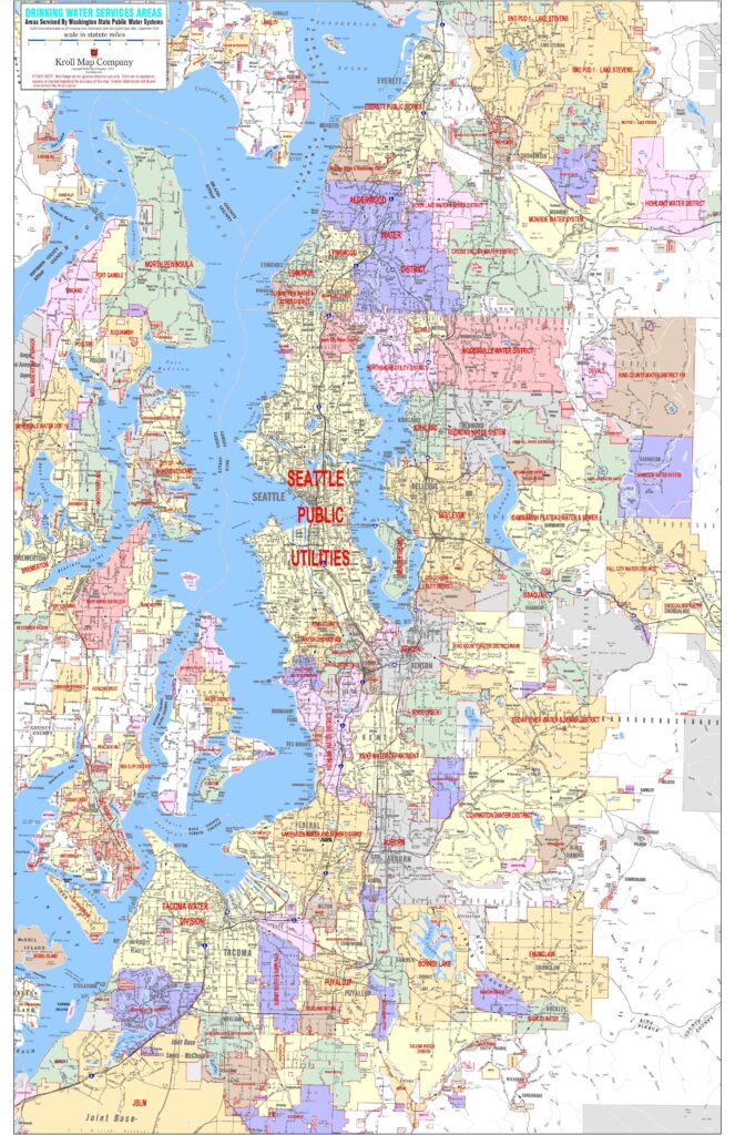
Drinking Water Service Areas are geographically defined mapped boundaries within a specific utility, municipality, or water system. DWSAs are responsible for supplying safe potable water to consumers and are necessary for managing infrastructure, ensuring quality compliance, and planning for future demand. Our map incorporates the GIS coverage offered by the Washington State Department of Health as of September 2025 in the Puget Sound region. The map is helpful to view all the boundary information at once on one of our most popular base maps.
Drinking Water Service Areas Map Download
Size: 14MB
94 Downloads
Note: This map is designed to plot at a minimum size of 24″ x 36″ up to 48″ x 72″.