Utility Mapping & GIS Services
GEO-REFERENCING
Kroll Map Company has extensive experience correlating not only our own historical images, but also practical experience geo-referencing client maps. Our cartographers seamlessly align spatial data ensuring precision in positioning. Trust us for comprehensive expertise in geo-referencing, facilitating accurate navigation and analysis of diverse cartographic datasets.
GEO-REFERENCED ORTHO-IMAGERY
Kroll offers high-resolution, geo-referenced ortho-imagery and can re-project to your coordinate system of choice (subject to availability). Our images are suitable for CAD and GIS applications, ensuring versatile and precise integration for your specific needs. Rely on Kroll for detailed and accurate spatial data to enhance your projects.
GIS/CAD INTEGRATION
Allow us to streamline the conversion of GIS data into practical CAD files for you. Our expertise ensures a seamless and efficient process, enhancing the usability of your spatial information.
UTILITY MAPPING
Experience a hassle-free transformation of your GIS data into functional CAD files with our expert assistance. We ensure a seamless and efficient conversion that maximizes the usability of your spatial information. Our skilled team uses the latest techniques to guarantee accuracy and compatibility, facilitating a smooth integration into your CAD environment. Benefit from our proficiency in spatial data management as we tailor the conversion to your specific needs, providing you with CAD files that align precisely with your project requirements. We’ve worked on larger projects with clients such as Seattle City Light transcribing 100-year old easement legal descriptions into a useable GIS platform. We’ve done smaller jobs such as helping Woodinville Water District with their backlog of mapping and inputting information into their ArcGIS. Kroll Map Company is registered with MRSC Rosters and we have the experience to get you where you want to be. Let us optimize your workflow, turning complex GIS data into accessible and usable CAD formats effortlessly.
Consider us your consulting engineering/mapping firm who will get the job done correctly, on time, and on budget.
DIGITIZING
If an existing geo-referenced raster image is not sufficient for your needs, Kroll can vectorize historical mapping and deliver in DWG, DXF, or SHP files for you.
BOUNDARY DELINEATION/ INTERPRETATION
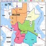
Kroll Map Company has experience interpreting and transposing legal descriptions into spatial coverages. Sound Transit, school districts, hospital districts, developers- all use our services to translate their written boundaries into clear, legible maps.


