Have you ever wondered how a massive continent like Africa or a sprawling metropolis like Tokyo can fit onto a single sheet of paper or a smartphone screen? The magic lies in map scale.
A map scale is the relationship between a distance on a map and the corresponding distance on the real earth. Without it, a map is just a drawing; with it, a map becomes an accurate, scientific tool for navigation and planning.
Cartographers express scale in three primary ways. Understanding how to read them is the first step to mastering map usage:
Graphic (or Bar) Scale: Understanding how to read a scale bar is crucial for accurately interpreting spatial information, whether you’re studying geography, architecture, engineering, or any field that uses scaled representations of space. This looks like a small ruler printed on the map. It shows visually how many miles or kilometers in the real world equal a specific length on the map. The biggest advantage? If you resize the map (like zooming in on a digital screen), the bar scale shrinks or grows with it, remaining perfectly accurate.
Verbal Scale: This expresses the relationship in words, for example: ‘One inch equals one mile.’ This means that if you measure one inch between two towns on the map, they are exactly one mile apart in reality.
Representative Fraction (RF): Written as a ratio like 1:24,000 or 1/24,000, this format is universal because it doesn’t rely on specific units. It means that one unit on the map (whether an inch, a camel, or a fingertip) equals 24,000 of those same units on the ground.
Large Scale vs. Small Scale
A common point of confusion for beginners is the difference between large and small scales. Think of it as a fraction:
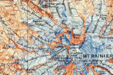
Large-Scale Maps: Show a large amount of detail for a small area (e.g., 1:10,000). A map of a city neighborhood or a hiking trail is large-scale; you can see individual buildings, streets, and contours.
Small-Scale Maps: Show a small amount of detail for a large area (e.g., 1:10,000,000). A map of the world or an entire country is small-scale; towns become mere dots, and highways become thin lines. A large scale map shows a smaller geographic area but with a higher level of detail. For example, a town plan or a hiking map might be on a scale of 1:10,000 or 1:25,000. These maps are called large scale because the representative fraction is relatively large, meaning that the objects on the map are drawn at a larger proportion of their actual size. This results in more detailed representations of features such as buildings, roads, and topographic details.
On the other hand, a small scale map covers a larger geographic area but with less detail. World maps, continent maps, or maps of large nations are examples of small scale maps.
0 Comments